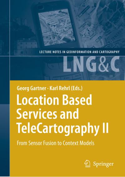
2010, ISBN: 3642099505
[EAN: 9783642099502], Neubuch, [PU: Springer Berlin Heidelberg Nov 2010], COMPUTERSCIENCE; LOCATIONBASEDSERVICES; NAVIGATION; TELECOMMUNICATION; CARTOGRAPHY; DEVELOPMENT; GEODESY; RADIO-F… Mehr…
| AbeBooks.de BuchWeltWeit Inh. Ludwig Meier e.K., Bergisch Gladbach, Germany [57449362] [Rating: 5 (von 5)] NEW BOOK. Versandkosten:Versandkostenfrei. (EUR 0.00) Details... |

2010, ISBN: 9783642099502
[ED: Softcover], [PU: Springer / Springer Berlin Heidelberg / Springer, Berlin], This book provides a general overview of research activities related to locati- based services. These acti… Mehr…
| booklooker.de |

2008, ISBN: 9783642099502
This book provides a general overview of research activities related to locati- based services. These activities have emerged over the last years, especially around issues of positioning,… Mehr…
| BarnesandNoble.com new in stock. Versandkosten:zzgl. Versandkosten. Details... |

2010, ISBN: 9783642099502
Paperback, New., 456 p. Lecture Notes in Geoinformation and Cartography . 63 Tables, black and white; 203 Illustrations, black and white; XXIX, 456 p. 203 illus. Intended for professional… Mehr…
| alibris.co.uk |

2010, ISBN: 9783642099502
Paperback, New., 456 p. Lecture Notes in Geoinformation and Cartography . 63 Tables, black and white; 203 Illustrations, black and white; XXIX, 456 p. 203 illus. Intended for professional… Mehr…
| alibris.co.uk |


2010, ISBN: 3642099505
[EAN: 9783642099502], Neubuch, [PU: Springer Berlin Heidelberg Nov 2010], COMPUTERSCIENCE; LOCATIONBASEDSERVICES; NAVIGATION; TELECOMMUNICATION; CARTOGRAPHY; DEVELOPMENT; GEODESY; RADIO-F… Mehr…

Herausgegeben:Gartner, Georg; Rehrl, Karl:
Location Based Services and TeleCartography II - Taschenbuch2010, ISBN: 9783642099502
[ED: Softcover], [PU: Springer / Springer Berlin Heidelberg / Springer, Berlin], This book provides a general overview of research activities related to locati- based services. These acti… Mehr…

2008
ISBN: 9783642099502
This book provides a general overview of research activities related to locati- based services. These activities have emerged over the last years, especially around issues of positioning,… Mehr…
2010, ISBN: 9783642099502
Paperback, New., 456 p. Lecture Notes in Geoinformation and Cartography . 63 Tables, black and white; 203 Illustrations, black and white; XXIX, 456 p. 203 illus. Intended for professional… Mehr…
2010, ISBN: 9783642099502
Paperback, New., 456 p. Lecture Notes in Geoinformation and Cartography . 63 Tables, black and white; 203 Illustrations, black and white; XXIX, 456 p. 203 illus. Intended for professional… Mehr…
Bibliographische Daten des bestpassenden Buches
| Autor: | |
| Titel: | |
| ISBN-Nummer: |
Detailangaben zum Buch - Location Based Services and TeleCartography II: From Sensor Fusion to Context Models Georg Gartner Editor
EAN (ISBN-13): 9783642099502
ISBN (ISBN-10): 3642099505
Gebundene Ausgabe
Taschenbuch
Erscheinungsjahr: 2010
Herausgeber: Springer Berlin Heidelberg Core >1
488 Seiten
Gewicht: 0,731 kg
Sprache: eng/Englisch
Buch in der Datenbank seit 2012-03-03T09:12:17+01:00 (Zurich)
Detailseite zuletzt geändert am 2024-01-06T16:21:56+01:00 (Zurich)
ISBN/EAN: 9783642099502
ISBN - alternative Schreibweisen:
3-642-09950-5, 978-3-642-09950-2
Alternative Schreibweisen und verwandte Suchbegriffe:
Autor des Buches: gärtner georg, karl georg, karl gartner, rehr, rehrl karl, schmidt felix
Titel des Buches: location
Daten vom Verlag:
Autor/in: Georg Gartner; Karl Rehrl
Titel: Lecture Notes in Geoinformation and Cartography; Location Based Services and TeleCartography II - From Sensor Fusion to Context Models
Verlag: Springer; Springer Berlin
456 Seiten
Erscheinungsjahr: 2010-11-22
Berlin; Heidelberg; DE
Gedruckt / Hergestellt in Niederlande.
Sprache: Englisch
160,49 € (DE)
164,99 € (AT)
177,00 CHF (CH)
POD
XXIX, 456 p. 203 illus.
BC; Hardcover, Softcover / Geowissenschaften/Geografie; Geographische Informationssysteme (GIS) und Fernerkundung; Verstehen; Computer Science; Location Based Services; Navigation; Telecommunication; cartography; development; geodesy; radio-frequency identification (RFID); Geographical Information System; Earth Sciences; Geowissenschaften; BB
Modelling.- A Formal Model for Mobile Map Adaptation.- Using Activity Theory to Identify Relevant Context Parameters.- Congestion Visualization Based on Probe Vehicle Data.- Where do you Roll Today? Trajectory Prediction by SpaceRank and Physics Models.- Ways of Walking – Developing a Pedestrian Typology for Personalised Mobile Information Systems.- Mapping Pedestrian Movement: Using Tracking Technologies in Koblenz.- TeleCartography.- Evaluation of User Variables in Topographic Feature Recall for the Informed Selection of Personalized Landmarks.- Measuring the Impact of Location-Awareness in the Acceptance of Mobile Systems.- Impact of Restricted Display Size on Spatial Knowledge Acquisition in the Context of Pedestrian Navigation.- User Requirements for Location-Based Services to Support Hiking Activities.- Geo-Identifi cation and Pedestrian Navigation with Geo-Mobile Applications: How Do Users Proceed?.- Neo-Cartographic Infl uence on Map Communication in LBS.- Location Based Services and Applications.- The Adoption of Mobile Location-Aware Systems for Field Police Work: Evaluation of a Pilot Initiative at the Dutch Police.- Enhancing the Experience of the Landscape: The Digital Dowsing Rod.- MNISIKLIS:Indoor Location Based Services for All.- geoHealth Monitoring –Real-Time Monitoring for Action Forces During Disaster Operations.- Modelling Home and Work Locations of Populations Using Passive Mobile Positioning Data.- A Geographical Information System for Real Estate (GEOVAL).- Positioning and Sensor Fusion.- Quality Assurance / Quality Control Analysis of Dead Reckoning Parameters in a Personal Navigator.- Efficient Overlay Mediation for Mobile Location-Based Services.- Three-Dimension Indoor Positioning Algorithms Using an Integrated RFID/INS System inMulti-storey Buildings.- Prediction of GNSS Availability and Accuracy in Urban Environments Case Study Schiphol Airport.- An Investigation of the Signal Performance of the Current and Future GNSS in Typical Urban Canyons in Australia Using a High Fidelity 3D Urban Model.- Using RFID and INS for Indoor Positioning.- GPS/WiFi Real-Time Positioning Device: An Initial Outcome.- LBS and TeleCartography II: About the book.- LBS and TeleCartography II: About the book.Gives a general picture of research-driven actitivities related to the context of location and map-based services Includes supplementary material: sn.pub/extras
Weitere, andere Bücher, die diesem Buch sehr ähnlich sein könnten:
Neuestes ähnliches Buch:
9783540873921 Location Based Services and TeleCartography II (Georg Gartner; Karl Rehrl)
< zum Archiv...

